Function 4 Improving the ecological status of a watercourse
Description
This function estimates the willingness to pay for an improvement in the ecological status of a watercourse. The function considers improvements to surface water quality, hydromorphology and biological water quality.
Required input data:
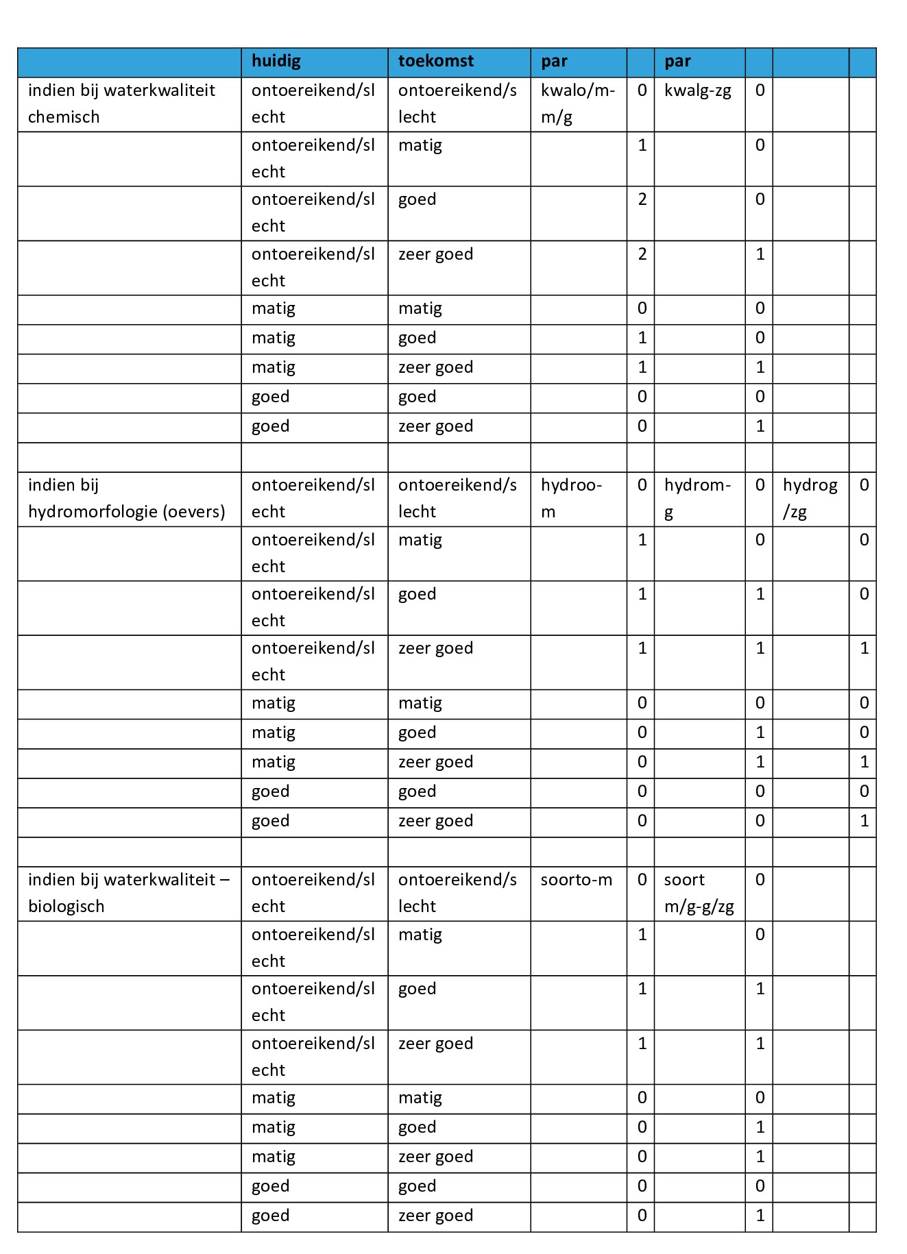
- Current water quality: inadequate, moderate, good, very good (physical chemical monitoring network VMM) http://www.vmm.be/geoview/
- Condition of the banks: ecologically inadequate (paved), moderate (natural materials, green banks), good (lowering dike with wetter landscape), very good (room for river: connecting meanders, removing dikes where possible)
- Biological water quality: inadequate, moderate, good, very good (biological monitoring network VMM) http://www.vmm.be/geoview/
- Condition of physical-chemical and biological water quality and condition of banks in future scenario.
- Number of km of watercourse that improves
- Basin in which this watercourse is located. The basin is automatically assigned based on the location of the measure and the map of river basins (sub-basins)
Quantitative and monetary valuation
The willingness to pay was estimated through various choice experiments using the Demer and the Nete or the Oude Kale and the Leie as case studies. More information about this can be found under background documents on the Nature Value Explorer website.
Assumptions
- The valuation only applies to navigable watercourses and watercourses of category 1. For smaller watercourses the results are more uncertain.
- The function can be combined with the other functions if it concerns a project that combines improvements to the watercourse with changes in land use in terrestrial ecosystems.
Functions to use
Low estimate:
BTB = (0.12 + 0.36 x kwalo/m-m/g +0.12 x kwalg-zg + 0.037 x hydroo-mat + 0.010 x hydrom-g + 0.015 x hydrog-zg + 0.18 x soorto-m + 0.16 x soortm-g/zg) x 77.42 x length of watercourse in km x 1000 + (0.022 + 0.15 x kwalo/m-m/g +0.052 x kwalg-zg + 0.016 x hydroo-m + 0.0043 x hydrom-g + 0.0064 x hydro g-zg + 0.075 x soorto-m + 0.069 x soortm/g-g/zg)x length of watercourse in km x 16.8% x number of households in the basin
High estimate:
BTB = (0.19 + 0.25 x kwalo/m-m/g + 0.17 x kwalg-zg + 0.028 x hydroo-mat + 0.0062 x hydrom-g + 0.0092 x hydrog-zg + 0.25 x soorto-m + 0.095 x soortm-g/zg) x 125.08 x length of watercourse in km x 1000 + (0.094 + 0.23 x kwalo/m-m/g + 0.16 x kwalg-zg + 0.026 x hydroo-m + 0.006 x hydrom-g + 0.008 x hydro g-zg + 0.22 x soorto-m + 0.087 x soortm/g-g/zg) x length of watercourse in km x 16.8% x number of households in the basin
To fill in
Determine in which basin the watercourse is located and look up the number of households. This table can be found in the background documents on the Nature Value Explorer website.
An example
For the example, we refer to the Dutch version of the manual.