Land use
To determine the land use within a scenario, the 10x10m Land Use 2019 map, which can be found on Geopunt, is used. The map for the Nature Value Explorer uses the same basic layers and methodology, but will divide the land uses into land use classes required for the tool. This map will be updated each time a new Land Use map is published. The Land Use Map is renewed every 3 years. The concept of "Land use" refers to the actual use of the land and is not necessarily the same as the legal-planning purpose.
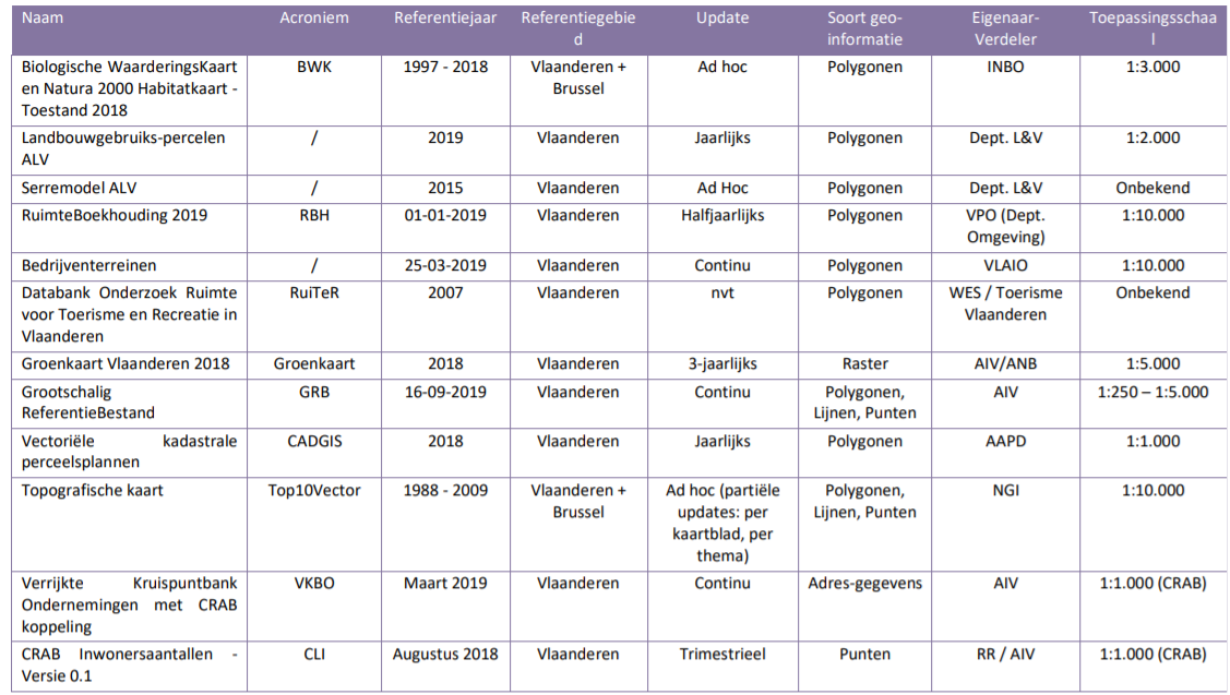
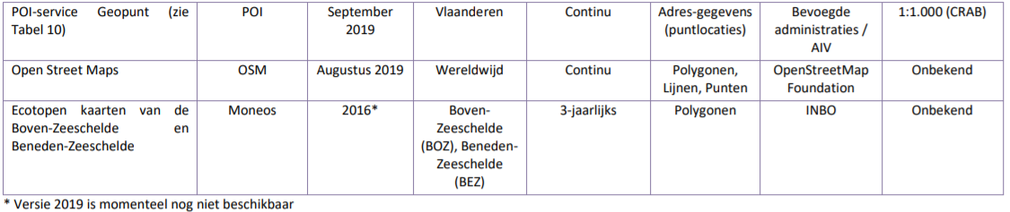
The methodology developed for this makes optimal use of the large amount of spatial (GIS) data that is currently available for Flanders and can be found in Poelmans et al. 2021. The table below provides an overview of the data used.
Table: Basic files used to compile the land use map